The weather in Stockholm will soon change into a significantly cooler version. After a couple days of temperatures around 30°C, things will change on Saturday...
A few hot days
For the time being, the highest temperatures yesterday, were measured in inland Arvika with 32.4°C, and today in Gladhammar with 33.2°C. Snösätra where i live, has been a bit"cooler" compared to Stockholm City, and it may not even reached 30°C yesterday, while the City of Stockholm officially stated 31.5°C maximum.
A low pressure area
is expected to develop over the Baltic sea. It should "collect" today's remnants and widespread T-storms over Germany (today) acting like a loose cluster - and then under the influence of cooler air from the NW, create that Baltic Sea low pressure area on its way to Finland. The hot air over Russia creating large contrasts in temperatures, leading somewhere along the threshold to dramatic low pressure development. The question is whee that takes place, which is always a gamble and difficult to predict.
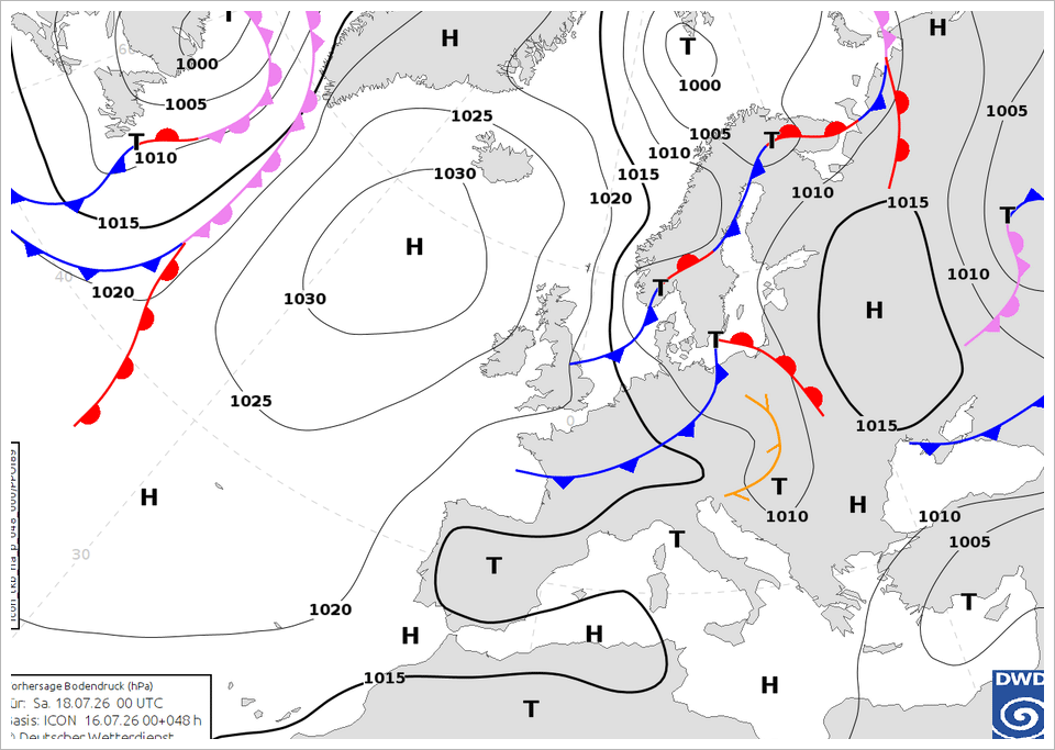
• German DWD weather chart prognosis for Saturday midnight
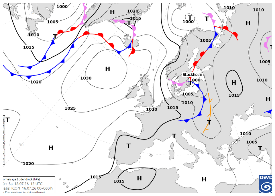
• German DWD weather chart prognosis for Saturday noon
Some of the weather centers
predict that this low will intensify into a small but fierce little storm along the east coast of Sweden and Stockholm, with storm winds wrapped around its core. Others lean now towards that it never fully develops - just passing by with rain, thunderstorms and cooler air. We may (or may not) get up to 25 mm rain during the weekend.
I doubt there will be thunderstorms associated with the low pressure passage. I would give Saturday noon a higher change for thunderstorms while we still reside within the warm air. Prior the passage of the low pressure area, and not after. In general i think the chances will be low. It is more likely that thunderstorms activity is higher on the continent (Germany, Poland), compared to little Stockholm lying at the periphery, as usual.
Time will tell. |