Since the day of the Eclipse, a warm front brought warmer airmasses to Scandinavia - which now make the temperatures soar anew. Some places today got temperatures up to almost 31°C.
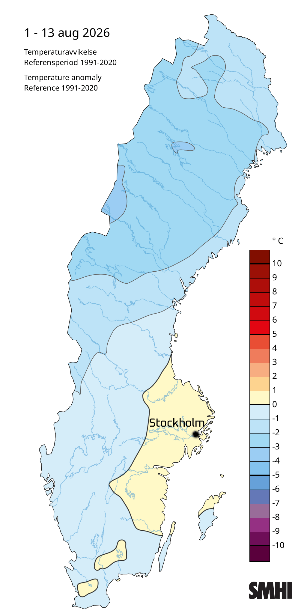
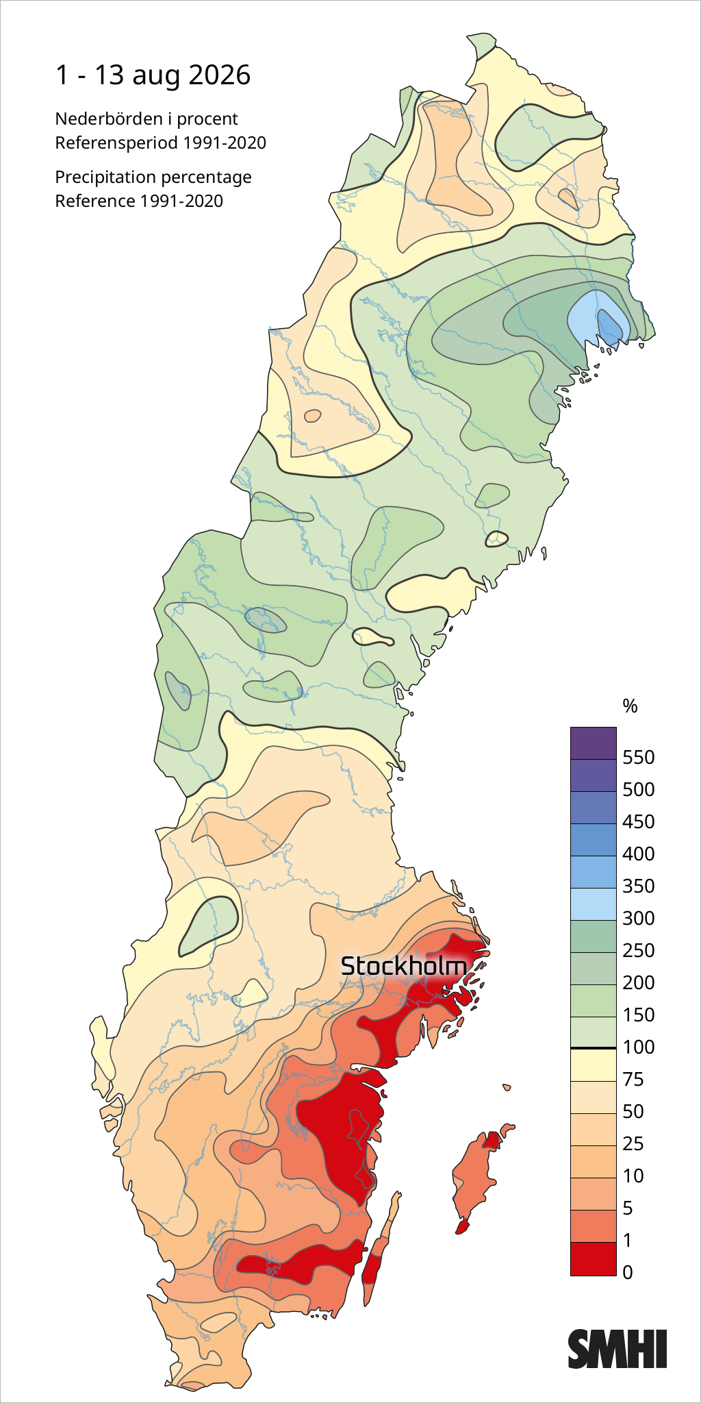
Yet, when I look at Sweden as a whole, the average temperatures in the first 13 days of August 2026 - have been mainly below normal - except for the larger Stockholm Region. It is surprising that the average for larger parts of Sweden have been below normal... So, there is that.
 . 
The way we feel temperatures... is a bit subjective
To be honest, here in Stockholm, August felt like a normal August. Some chillier nights - which felt colder than they really were, simply because from here on - you always feel that a night temperature of 10-12, feels almost "cold". But that's because we got used to the warmer temperatures.
In Springtime it is the other way around - when the temperature goes up to 5°C it almost feels "mild", after a long winter time.
When I went up to the Skinnarviksberget Hill in the Southern part of the city, it felt almost "cold" - yet it was around 12-13°C at 06.30 in the morning. Plus that the wind wasn't all calm, which contributed to that chilly feeling.
If I had a morning temperature of 12°C in the morning in March or April - boy it would feel almost summer mild.
Strange, isn't it ?
Swoopy-doopy, soon gone
The war airmass culminates tomorrow and could bring us 30°C in the eastern parts of middle Sweden. From there on however, a cold front will swoop it all away - and we return to normal temperatures again, with typical Swedish summer weather: 19-20°C during daytime, and some after noon shower, and 12-14°C early morning before sunrise.
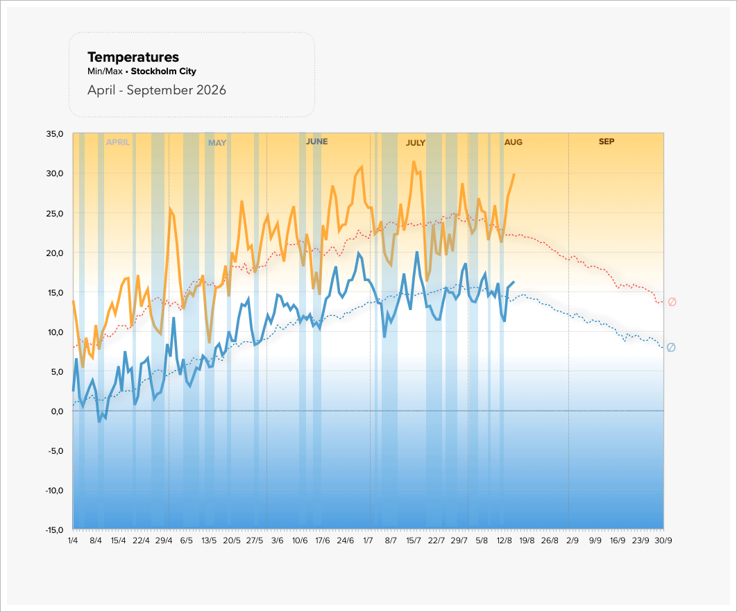
Temperatures this far since April (until today) 2026
Here you see Stockholm City's MAX and MIN temperatures as well what is normal - with the broken lines (representing the average MAX and MIN of 1991-2020).
I marked the periods where temperatures dipped below average with blue pillars.
You can see that the end of July was a bit so-so, with rather chilly daytime temperature - also bringing down the average for the whole month. June 2026 on the other hand was worth the name high seasons summer. But there was another hot peak in the middle of July as well.
27 Summer days (this far)
So far we have had 27 summer days this year (at and above 25°C). WE counted in total 4 hot days (at/above 30°C). Will see if we make it to the 5th tomorrow.
I often consider those thresholds a bit funky - because the inner city, more easily reaches the levels, creeping just above the 30° threshold, as the city creates a hot air bubble. I don't think we had as many hot days in Snösätra - because i know that several times the temperatures stayed like 2-3°C below the value of Stockholm City.
So, there is that... with statistics
No thunderstorms since 5 July 2026
Remarkable is the absence of thunderstorms. There have been none since 5 July... So, just another very poor thunderstorm year here in Stockholm.
Woopi.
Tullinge station active again
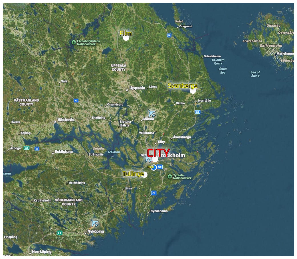
I am thrilled that the Weather station in Tullinge (former military airfield) is active again. It appears that they repaired it - as it was gone for several month. I consider that station to be very important - because of its location, (7 km from my place in the southern suburbs). Tullinge sits far outside of Stockholm, and the influence of the warm air bubble. Therefore, minimum temperatures there, can be MUCH lower compared to Stockholm City.
- Sometimes with a difference up to 10°C !!
Tullinge acts a little bit like "frost hole" (köldhål)
Places where you get in particularly cold temperatures at night. North of Stockholm, we have other cold spots, like the station Film in Uppland, and one near Norrtälje called Svanberga, just north of Norrtälje - altogether NE of Stockholm "in the middle of nowhere". Those stations tend to get really cold temperatures sometimes, while it is still mild in Stockholm City.
Together they represent a way to know, what temperatures you would get if there wasn't any city heat influence Totally unaltered, in other words.
"Global Boiling" you get in the dense, warm cities... because their temperatures are artificial, giving off false impressions, what it is really like way outside of them.
Daytime MAX do not differ much
During daytime, the differences in MAX temperature are not particularly large, often 1°C or less, no matter if it is Norrtälje, Film or Tullinge. Coastal station are tricky, too, because the sea water affects the temperatures there. Stations like the Swedish military center; Berga.
In spring you often get colder temperatures (subdued due to cold waters), and in autum Berga shows warmer temperautres at night, due to the residual warmth stored in the Baltic Sea.
|